Geography is not dead.
Why fear, not ideology, is the force redrawing borders, alliances and strategic corridors
By Adelio Debenedetti, author of The Naacal Protocol – Code 211

For a couple of decades, the conventional wisdom in Washington and in the boardrooms of American industry was that geography had lost its grip on the fate of nations. Globalization, the theory went, had erased distance. The internet had turned the planet into a network with no center. Free trade would make war too expensive even for great powers. Borders still existed on maps, but they mattered less than financial flows, supply chains and fiber-optic connections. It was a comforting story. It was not, however, an accurate one.
Geography never went away. It simply moved beneath the surface - into ports, straits, pipelines, undersea cables, and the routes along which ships, data, energy and military reinforcements must travel. For years, the United States and its allies stopped paying close attention to it, because the international system seemed stable enough to make it invisible. Then fear came back. And with it, the deep lines of power reemerged. This is not always the fear of imminent war. More often it is the fear of being cut off - of losing a route, of becoming dependent on a rival power, of discovering too late that some far-off region has become indispensable. That fear, more than any formal doctrine, is now redrawing alliances, military posture and strategic corridors from the Arctic to the Taiwan Strait to the Panama Canal. The political map still shows nation-states. The real map shows their vulnerabilities.
The return of distance.
In the early 1990s, the collapse of the Soviet Union seemed to confirm the idea that economics would gradually displace geopolitics. Supply chains stretched across continents. American firms moved factories and know-how to Asia. The security of shipping lanes became something close to an assumption baked into every spreadsheet. Goods arrived, data flowed, logistics costs fell. Few people asked what would happen if one of those flows were deliberately cut. The system worked because most of its infrastructure was treated as neutral. A port was a port. A pipeline carried energy. An undersea cable belonged more to the realm of engineering than to the realm of defense. That distinction has become far less credible.
A commercial terminal can support the deployment of a naval fleet. A civilian satellite can hand an army decisive imagery. A telecommunications cable can become a strategic target. A runway built to connect a remote community can just as easily receive military aircraft. The same infrastructure that sustains cooperation in peacetime becomes an instrument of pressure in a crisis. This ambiguity defines today's gray zone. An adversary rarely needs to occupy territory to shape another country's choices; it is often enough to control what connects that territory to the rest of the world. Geography, in this sense, no longer means only mountains, rivers and borders. It now includes the artificial architecture built above and below the terrain: power grids, ports, radar installations, satellites, digital backbones, ammunition depots, rail hubs. Nature sets the chokepoints. Technology can modify them. It rarely erases them.
Fear as a cartographic force.
Military alliances are usually described as communities of shared values. They are, at least in part. But when the perception of threat rises, their underlying structure reveals a more concrete logic: protect territory, keep lines of communication open, and prevent a rival from turning a piece of geography into political leverage. Finland and Sweden's entry into NATO is the clearest recent example. It didn't change the physical shape of Northern Europe, but it redrew the strategic geometry of the region. Nearly the entire Baltic coastline - Russia's excepted - now belongs to alliance members. Finland brought a long land border with Russia; Sweden added territorial depth, infrastructure, and the strategic value of the island of Gotland. Fear of isolation produced more integration. A political choice changed the military function of territory.
The same mechanism plays out along Europe's eastern flank. The Suwalki Gap - the narrow strip of land between Poland and Lithuania, squeezed between the Russian exclave of Kaliningrad and Belarus - has taken on an importance wildly disproportionate to its size. In peacetime it is an internal border between allies. In a crisis, it could become the decisive link between the Baltic states and the rest of Europe. Fear didn't create that chokepoint. It simply made it visible — and it is precisely the same debate, in a different register, that has consumed Washington's own defense establishment over the past two years, as the Pentagon and Congress argue over how much American force posture in Europe should shrink and how much of that burden NATO's European members should absorb themselves.
The GIUK Gap - Washington's Arctic Reckoning
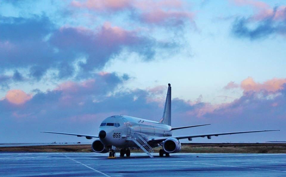
If the Suwalki Gap is a land chokepoint, the GIUK Gap is its oceanic equivalent - and it is also the single clearest place where this abstract theory of "fear redrawing the map" has become literal, front-page American news. The stretch of ocean between Greenland, Iceland and the United Kingdom isn't marked by walls or border posts. On an ordinary map it's simply open water. On a strategic map, it is one of the most important thresholds in the North Atlantic. During the Cold War, it was the line Soviet submarines had to cross to threaten the sea lanes linking North America to Europe. Watching it meant listening to the ocean, tracking invisible movements, making sure the Soviet Northern Fleet could never operate freely against NATO's reinforcement routes. The dissolution of the Soviet Union reduced the Gap's perceived importance. It did not change the physical distances between Russia's Kola Peninsula, the Arctic and the Atlantic. What changed was the level of fear through which Washington and its allies looked at the map.
That fear is back - and this time it has a distinctly American face. Since early 2026, President Trump has repeatedly pressed for greater U.S. control over Greenland, at times declining to rule out military or economic coercion to obtain it, arguing the Danish territory is indispensable to American security in an Arctic increasingly contested by Russia and, in cooperation with Moscow, China. The pressure escalated sharply at the start of 2026, touching off protests across Greenland and Denmark and a standoff with European allies, before Trump stepped back from threats of force at the Davos summit that January. Reporting in recent weeks has described a Trump-linked oil company moving to drill on Greenland's coast even without local approval - a sign, critics argue, that the pressure campaign continues in a different form.
Strip away the diplomatic noise and what's left is the exact logic this dossier keeps returning to: Greenland's value has never been about the ice. It's about who controls the approach to the GIUK Gap, and therefore who can bottle up - or free - the Russian submarines that must pass through it to reach the open Atlantic. Whatever one makes of the administration's methods, the underlying strategic argument is one that American admirals and Danish diplomats alike would recognize instantly. NATO's own doctrine on deterrence and defense increasingly treats the Arctic and the North Atlantic as a single operational theater, built around the ability to keep infrastructure running and rush reinforcements to exposed territory. Borders, in other words, still matter. But increasingly, what matters more is who controls the routes through which they can be defended - and reasonable people in both parties disagree sharply about whether pressuring a NATO ally's territory is the right way to secure those routes, or whether it hands Moscow and Beijing a propaganda win at America's expense.
It's precisely at this intersection of real geopolitics and imagination that The Naacal Protocol - Code 211 finds its footing. Base Krigan, the hidden Arctic installation at the center of the novel, isn't simply a piece of technothriller set dressing: it embodies the idea that the most consequential power doesn't sit where official maps point, but in the spaces from which someone can observe, intercept or interrupt whatever passes through a region. Its narrative logic is drawn straight from the real one - controlling a corridor usually means controlling an adversary's options before a crisis ever begins.
From the Atlantic to Taiwan
The same logic runs through the Indo-Pacific. Taiwan is usually described as the flashpoint between Beijing and Washington, or as the epicenter of the world's advanced semiconductor manufacturing — the reason Congress passed the CHIPS Act and why American industrial policy now treats a shortage of Taiwanese fabrication capacity as a national-security question, not merely an economic one. Both readings are correct. Neither is sufficient. The island sits at the center of the First Island Chain, stretching from Japan to the Philippines. Control of Taiwan would reshape China's access to the western Pacific, affect the defense of Japan's southern islands, and increase pressure on regional shipping lanes. Taiwan isn't only contested territory; it is a geographic, industrial and military gateway at once.
Here, too, fear produces competing maps. To Beijing, the U.S. and allied military presence along the First Island Chain can look like a containment structure. To Washington and to many governments across the region, China's naval expansion and mounting pressure around Taiwan feed the fear that the balance could be altered by force or by gradual coercion. Polling has shown American public opinion split and uncertain on how far the United States should go to defend Taiwan militarily — support for the island runs high in the abstract, but enthusiasm drops when Americans are asked about the cost of direct confrontation with a nuclear power. Neither side has to want war for the territory to become militarized. It's enough that each fears what the other might do. That dynamic produces distributed basing, access agreements, exercises, logistics depots, surveillance networks. The goal isn't only to prepare for a fight — it's to make credible the capacity to withstand a blockade, keep links open, and prevent a local crisis from becoming an irreversible fait accompli. Deterrence, in cases like this, is often born from a shared geography of fear: each side builds its defenses by watching the other's, and every precautionary measure can look, from across the strait, like the first step of an offensive.

The Arteries of the World
The great maritime corridors confirm just how fragile the idea of a distance-free planet really is. Suez, Bab el-Mandeb, Hormuz and Malacca concentrate an essential share of the world's trade and energy flows into remarkably narrow spaces. When one of those passages becomes unsafe, the consequences don't stay local - routes lengthen, costs rise, insurers react, and supply chains have to be rethought. According to the United Nations, more than 80 percent of world trade by volume moves by sea - global prosperity depends on a network of arteries with no real, immediate alternative. Washington has its own version of this story, and it is currently playing out in Panama. Trump threatened early in his second term to reassert U.S. control over the Panama Canal, arguing the waterway - handed over to Panama in 1999 - had fallen effectively under Chinese influence through the operations of the Hong Kong firm CK Hutchison at two of its ports. Panama's Supreme Court subsequently ruled those port concessions unconstitutional, a decision Washington treated as a win and Beijing denounced as the product of American pressure. Roughly 40 percent of U.S. container traffic moves through the canal each year, carrying an estimated $270 billion in cargo - which is exactly why a five-percent sliver of global shipping capacity can dominate a White House briefing. It is the Suez-Hormuz-Malacca logic, transplanted into the Western Hemisphere and stamped with an unmistakably American argument about hemispheric primacy.
The Strait of Malacca tells a parallel story on China's side of the ledger: it links the Indian Ocean to the South China Sea and is essential to Asia's economies. Its vulnerability has pushed Beijing to build ports, overland corridors and strategic relationships designed to reduce dependence on a single passage — and the Belt and Road Initiative itself can be read the same way: not simply economic expansion, but an attempt to redraw the geography of dependency. The same holds for Europe's energy corridors. Pipelines, LNG terminals, electricity interconnectors and storage facilities have all become matters of national security. When energy stops being seen as a reliable commodity, the infrastructure that carries it enters the realm of strategic planning. Fear of dependency changes suppliers, routes and alliances. Economic geography and military geography end up overlapping. The port that receives a merchant ship can just as easily support a naval task force. The rail line linking two markets can become a reinforcement corridor. The cable carrying financial transactions can take on the same strategic weight once reserved for a bridge or a fortress.
Security begins below the surface
A growing share of this geography isn't immediately visible. The seabed carries the cables through which most intercontinental digital communication passes. In the same space run electrical interconnectors and energy pipelines. Their sheer extent makes continuous protection impossible, while the difficulty of definitively attributing any damage creates ideal terrain for ambiguous operations. An incident can be exactly that - an incident. It can also be a warning.
That uncertainty is precisely what makes undersea infrastructure such an effective tool of gray-zone competition. A direct attack on a country can trigger a military response. A malfunctioning cable, interference with a satellite signal, or a suspicious ship's passage instead requires time to interpret — and in that window, an adversary can watch the reaction, measure the system's resilience, and seed alternative narratives about what actually happened. Baltic Sea cable-cutting incidents involving vessels linked to Russia's "shadow fleet" have already forced NATO to stand up new patrol missions to monitor exactly this kind of ambiguity. The European Union now formally treats cyberspace as a contested strategic domain and stresses the interdependence between digital networks and physical infrastructure, including energy and transportation systems. It marks a deep shift: security is no longer only about defending territory, but about the continuity of the systems that let that territory function at all. A nation can keep its borders fully intact and still lose its freedom of action if its communications are severed, if it cannot receive energy, or if its forces cannot move. Sovereignty today depends on the ability to keep connections open.

The map drawn by the adversary
Every power tends to present its own military posture as defensive. The trouble is that no one builds strategy purely on the basis of another country's declared intentions. Intentions can shift quickly; ports, fleets and bases remain. That's why fear is such a powerful cartographic force: it pushes states to look at territory the way an adversary would. A valley becomes an invasion route, an island becomes a surveillance platform, a port becomes a point of access, a linguistic minority becomes potential political leverage. Strategic planning begins the moment ordinary geography gets reread in terms of vulnerability. None of this means every piece of infrastructure conceals a military purpose, or that every foreign investment is part of a hidden plan - that kind of reading collapses analysis into conspiracy. It means, more simply, that infrastructure carries strategic consequences even when it was built for purely economic reasons.
The line between civilian and military use isn't fixed. It depends on context, on technology, and above all on how threatening something is perceived to be. That is where the real gray zone forms — not in a world run by all-powerful conspiracies, but in the much more concrete space where commerce, security and intelligence share the same territory, and sometimes the same networks.
The invisible geography of power.
Twenty-first-century geography doesn't look like the atlases Americans grew up with in school. Capitals still matter, but power increasingly runs along less obvious corridors: between Greenland and Iceland, beneath the Baltic, around Taiwan, through the Strait of Malacca, along the ports of the Indian Ocean, and across the seabeds carrying the world's digital cables. Those spaces determine how quickly a military force can be reinforced, how long an economy can withstand a disruption, and how much political autonomy a state retains during a crisis. Fear doesn't erase the maps we already have. It draws a second one over the top.
On that second map, a small island can be worth more than a large region, a radar station can matter more than a city, and a line traced along the ocean floor can outweigh a land border. It's the map strategists consult when weighing not what is happening, but what could. The globalized world didn't defeat geography. It made geography more complicated, linking distant places through systems that are as efficient as they are vulnerable. The more we depend on those connections, the greater the power of whoever can watch them, pressure them, or cut them off.
Geography isn't dead, because fear has never stopped assigning value to place. And as long as great powers keep fearing isolation more than they fear distance, it will be the corridors, the chokepoints, and the seemingly empty spaces that decide where peace ends and the gray zone begins.
This article is part of the Grey Zones Archive editorial project, a long-form analysis series focused on Arctic geopolitics, strategic chokepoints, cognitive warfare, hybrid conflict, dual-use infrastructure and the evolving balance of power in the 21st century. The analyses published on The Naacal Protocol Blog explore the increasingly blurred line between intelligence, strategic geography and contemporary geopolitical narratives, in continuity with the research-based universe of The Naacal Protocol – Code 211 by Adelio Debenedetti.


Comments