The chokepoint of power.
Straits, ports, undersea cables and rare earths: the places where the world can be stopped
By Adelio Debenedetti, author of The Naacal Protocol – Code 211
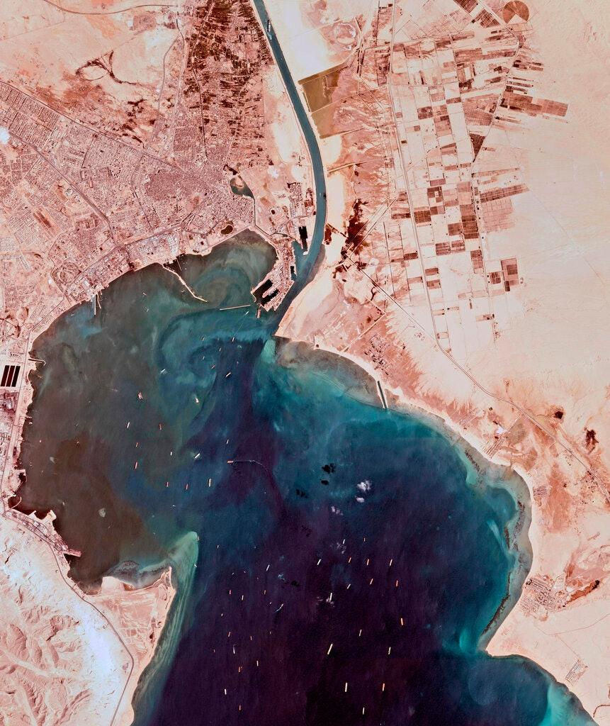
For nearly a week in March 2021, the bow of a container ship sat wedged into the eastern bank of the Suez Canal. The Ever Given was 1,300 feet long, carrying thousands of containers, and it had come to rest in precisely the wrong spot. Behind it, a queue formed -tankers, industrial components, food shipments, cargo bound for markets in Europe, Asia and, ultimately, American ports and store shelves thousands of miles away.
There had been no war. No government had ordered a blockade. No military had closed the canal. And yet, for several days, a slice of the world economy discovered it depended on the position of a single hull.
The episode exposed something globalization had let slip out of view. International trade can spread production across continents, park data in the cloud, and multiply suppliers -but it cannot eliminate the chokepoints. Goods still have to pass through straits and canals. Ships still have to enter ports built to receive them. Data still travels through cables that come ashore in a handful of precise locations. Minerals mined in one country still have to be refined in plants that often sit on the other side of the world.The global network is vast. It is not uniform. In certain places it narrows down to a single valve.
These are the chokepoints of power: geographic or technological locations where such a large share of global flows converges that disrupting them produces consequences far beyond the point of disruption. A strait a few dozen miles wide. A port terminal. A cable landing station. A plant that separates rare earths. They don't all take the same form, but they share one trait: replacing them takes longer than any crisis typically allows.
Contemporary power isn't only about owning territory. It's about knowing which flows cross that territory, and where they can be slowed down -a lesson Washington has relearned the hard way over the past six months.
The false comfort of open routes.
Maritime shipping moves roughly 80 percent of world trade by volume -a dependency that goes unnoticed in daily life, because when the system works, ships stay out of view. They cross oceans, enter terminals, unload containers and depart on schedules built to minimize both time and inventory.
Efficiency drove costs down. It also eroded the margin for error. The just-in-time model assumes goods arrive when needed and that routes stay reliably open. When a link breaks, American manufacturers and retailers can't always count on deep warehouse reserves: they have to wait, pay more, or scramble for an alternative.
The trouble is that a real alternative often doesn't exist. Working around a chokepoint doesn't mean taking a parallel road -it can mean sailing around an entire continent, switching ports, shifting cargo onto a rail network with limited capacity, or rethinking an entire production chain.
When ships avoid Suez and round the Cape of Good Hope instead, trade doesn't stop, but distances, fuel burn, crew costs and insurance premiums all rise. Ships stay at sea longer, which quietly shrinks the shipping capacity available everywhere else. A local problem starts propagating through the entire system -and it's American consumers, at the end of long supply chains that run through Walmart and Amazon warehouses, who eventually feel it in shipping delays and price tags.
Simultaneous trouble in the Red Sea and the Panama Canal has already shown how fragile this architecture can be. In one case, threats to shipping pushed carriers to reroute entirely. In the other, drought lowered water levels and forced authorities to cap the number of transits. At Suez the pressure came from war; at Panama, from the climate -but the economic effect looked much the same: fewer passages, longer voyages, higher costs. Geography doesn't distinguish between a military crisis and a climate one. It only measures how hard it is to go another way.
Hormuz, the valve on the world's energy supply.
Between Iran and the Arabian Peninsula, the Strait of Hormuz connects the Persian Gulf to the Gulf of Oman and, from there, the Indian Ocean. At its narrowest point it measures barely twenty miles across; the shipping lanes used by large tankers occupy an even smaller sliver of that space.
A decisive share of Gulf energy exports moves through Hormuz. Tankers and LNG carriers have no choice but to cross it before heading to Asia, Europe or other markets. Under ordinary conditions, U.S. Energy Information Administration data put the volume moving through the strait at roughly 20 million barrels a day of crude and petroleum products.
For most of this year, conditions have been anything but ordinary. Since the United States and Israel launched strikes on Iran at the end of February, Hormuz has gone from theoretical chokepoint to the site of the most disruptive maritime crisis in the Gulf in a generation. Iranian forces have mined the strait, boarded and struck commercial vessels, and warned tankers away entirely; Washington answered with an air campaign against Iranian naval targets and a naval blockade of Iranian ports that remains in place today. Traffic through the strait, which UK Maritime Trade Operations once tracked in the dozens of vessels daily, collapsed to a fraction of pre-war levels before recovering only partially in recent weeks, and Gulf state officials have accused Tehran of using the waterway as, in the words of one senior UAE diplomat, "a tool of economic coercion and blackmail." Energy Secretary Chris Wright told reporters this month that daily flows through Hormuz are running at roughly 8 to 9 million barrels -well under half of normal.
This is what happens when a chokepoint's strategic value stops being theoretical. For decades, Hormuz was the textbook example of a strait so important that merely threatening it moved markets -a credible threat, a seizure, a damaged ship, a military exercise was usually enough to send insurance rates and shipping costs climbing without a single barrel actually being blocked. This year, the theory and the reality converged: the strait's power turned out to be exactly as real as analysts had always warned, and a fuel crisis rippled outward across Asia and the global economy within weeks.
Hormuz's power was always part physical, part psychological. The strait carries energy, but it also carries expectations. Every local flare-up gets read instantly through the question that has shadowed Gulf security for decades: what happens if the passage actually closes? This year, for the first time in a generation, the world found out.
Malacca and China's dilemma.
On the other side of the Indian Ocean, the Strait of Malacca separates the Malay Peninsula from Indonesia's Sumatra. It links the Indian Ocean to the South China Sea and offers the shortest route between the Persian Gulf and East Asia's industrial centers.
For China, Japan, South Korea and Taiwan, it's one of the primary arteries for energy and trade. According to the U.S. Energy Information Administration, more than 20 million barrels a day of oil and liquid fuels pass through Malacca -by volume, one of the largest energy chokepoints on Earth.
China's dependence on this passage is often called the "Malacca dilemma." The term captures an obvious vulnerability: a substantial share of China's energy imports has to cross a relatively narrow space, ringed by states outside Beijing's control, close to routes patrolled by the U.S. Navy and its allies -the same navy that has spent this year demonstrating, in the Gulf, exactly how disruptive a determined actor can be at a chokepoint like this one.
None of this makes a Malacca closure simple or likely -a blockade would carry enormous costs for every Asian economy and for the world at large. But strategic planning doesn't stop at the most probable scenario. It has to account for the most damaging one too.
China has responded by trying to reduce its exposure: overland oil and gas pipelines, investment in Indian Ocean ports, links through Pakistan and Myanmar, and the broader development of alternative routes. The Belt and Road Initiative itself can be read as a geographic response to this concentration of risk -creating more access points, spreading out infrastructure, and preventing any single threshold from being able to isolate the Chinese economy.
Building an alternative corridor, though, doesn't eliminate dependency -it usually just relocates it. A pipeline needs pumping stations, terminals, transit territory. A railway crosses borders and politically unstable regions. A distant port needs roads, security, and long-term agreements.
Every fix creates new vulnerable points. The geography of power doesn't disappear. It changes address.
Suez, Bab el-Mandeb and the african detour.
The Suez Canal and the Bab el-Mandeb strait belong to the same artery. The first connects the Mediterranean to the Red Sea; the second opens the Red Sea to the Gulf of Aden and the Indian Ocean. If either becomes unsafe, the entire Europe-to-Asia route loses much of its advantage.
Bab el-Mandeb means "Gate of Tears" in Arabic. The name predates modern geopolitics by centuries, but it fits the place well. The strait sits between Yemen, Djibouti and Eritrea, in a region shaped by war, regional rivalry and foreign military presence. Commercial ships heading for Suez have to pass close enough to shore to be spotted -and, under the wrong conditions, struck, as Houthi attacks on shipping have repeatedly demonstrated over the past two years and continue to demonstrate this month, with a strategic port in Yemen shut down by fresh strikes in mid-August.
Djibouti, on the African shore, hosts military installations belonging to the United States, France, China, Japan and others. That concentration has nothing to do with the small country's own economic weight and everything to do with its location: from there, it's possible to watch Bab el-Mandeb, support operations in the Horn of Africa, and maintain a presence along one of the planet's most important trade routes. The port becomes part of the chokepoint. Controlling the water isn't enough -someone needs a place to refuel ships, launch aircraft, gather intelligence, and protect operations.
When Red Sea shipping gets too risky, carriers can choose to round the Cape of Good Hope instead. The alternative route exists, but it turns the entire African continent into a detour -a near-perfect illustration of the gap between theoretical redundancy and real-world resilience. Trade continues. It simply pays the price of distance. Suez isn't indispensable because no other sea exists. It's indispensable because the alternative costs time, fuel and ships that the system has learned not to keep in reserve.
Panama, the chokepoint made of fresh water.
The Panama Canal is often pictured as an artificial shortcut between two oceans. It's actually a complex hydraulic system that depends on fresh water: locks raise and lower ships using enormous quantities of water drawn from the reservoirs that feed the canal.
When rainfall drops and lake levels fall, canal authorities have to limit how deep a ship can sit in the water or cut the number of transits allowed each day. A route built to defeat geography ends up at the mercy of local weather instead.
Panama's vulnerability adds a new dimension to chokepoint security. Not every chokepoint is threatened by fleets, missiles or sabotage -some simply lose capacity to drought, rising seas, extreme weather, or aging infrastructure.
The old line between military security and environmental security stops being useful. A manufacturer waiting on industrial components doesn't much care whether the delay came from an attack in the Red Sea or a shortage of water in Panama -either way, the supply chain misses its window. And in Panama's case, the environmental vulnerability has run alongside a very different kind of pressure: renewed American interest in the canal's control, following the Trump administration's push over the past two years to curb Chinese port operations there and, at moments, to threaten reasserting direct U.S. control of the waterway itself. A single corridor, in other words, has spent the past year facing both a climate stress test and a great-power one -proof that the same chokepoint can be squeezed from two entirely different directions at once.
Climate change, in that sense, is also redrawing the geography of fear. Routes no longer get evaluated only for distance and political risk, but for their ability to function under conditions different from the ones they were built for.
The ports that govern the routes.
A strait forces ships through a narrow space. A port concentrates everything that happens before and after that passage. Containers, fuel, minerals and food can cross thousands of miles, but they still have to stop at terminals with the right cranes, the right depth, and the right land connections.
Bigger container ships made shipping more efficient -and shrank the number of ports able to handle them. A megaship can't simply be rerouted anywhere: it needs sufficient draft, long enough berths, cranes with the right reach, and a rail or road network able to clear the cargo.
A port, then, is a piece of territorial machinery. Its importance depends not just on its spot on the coastline but on the corridors that connect it inland. Rotterdam matters because it opens onto Europe's industrial core. Singapore matters because it links Malacca to Asia's transshipment networks. Piraeus, Tangier Med, Colombo, Gwadar all gain value as they become nodes in larger routes.
Foreign investment in ports draws increasing scrutiny for exactly this reason -a pattern Washington has watched with particular unease as Chinese state-linked firms have built out port holdings from Africa to Latin America. A commercial contract doesn't automatically mean military control of a piece of infrastructure -it would be a mistake to treat every foreign-financed terminal as a hidden base. But running a port can offer insight into trade flows, economic leverage, and a durable presence in a strategic region.
The picture gets more delicate when infrastructure is dual-use. The features needed to move cargo can just as easily support a naval force. A commercial pier can receive a warship; a fuel depot can serve both purposes; a civilian logistics network can become essential in a crisis.
The gray zone doesn't come from every port hiding a secret function. It comes from the possibility that a civilian function can be repurposed quickly for a strategic one.
The cables the sea hides.
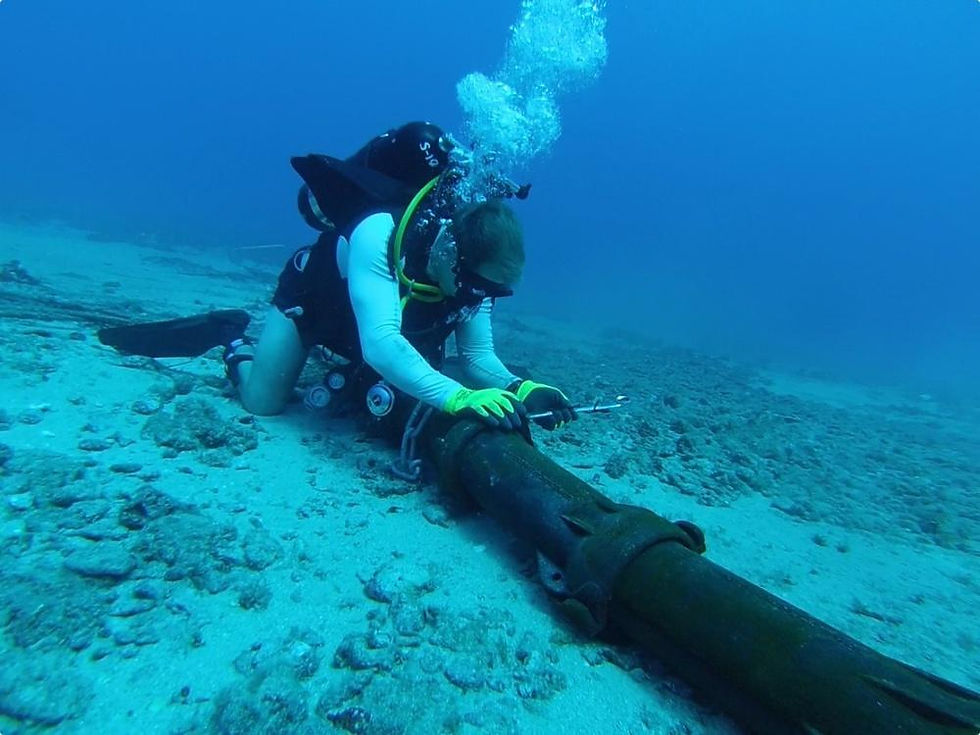
If cargo mostly travels by ship, data crosses the oceans almost entirely below the surface. More than 99 percent of international data traffic runs through a network of roughly 500 undersea cable systems stretching over 900,000 miles.
The image of the digital world as something weightless and placeless is misleading. The cloud has a precise geography: data centers, coastal landing stations, and thin bundles of fiber-optic cable laid across the ocean floor.
Cables aren't spread evenly. They follow the most economically convenient routes and come ashore where they can connect to national networks. Some coastlines host many landing stations; others depend on just one or two links. When several cables cross the same stretch of sea or converge on the same coastal area, the network's supposed redundancy can turn out to be thinner than it looks.
Most cable damage isn't hostile. Anchors, fishing gear, underwater landslides, earthquakes and simple wear cause hundreds of incidents every year, according to the International Telecommunication Union -and repairs depend on a strikingly small global fleet of specialized cable-repair ships.
That very normalcy is what opens the door to ambiguity. When a cable fails in a strategically sensitive area -as has repeatedly happened in the Baltic Sea over the past two years, in incidents U.S. and European officials have linked to vessels tied to Russia's "shadow fleet" -telling accident from sabotage right away can be genuinely difficult: someone has to trace ship movements, examine the seabed, reconstruct what happened. Attribution takes time. Disruption doesn't wait for it.
An adversary can exploit that uncertainty without ever claiming responsibility for anything. It can gauge how quickly others respond, seed conflicting narratives, and force other states to commit naval resources to protect thousands of miles of infrastructure they can never fully watch.
The digital chokepoint doesn't necessarily sit at the spot where a cable gets cut. It can sit in the station that connects the cable to the land network, in the port a repair ship sails from, or in the availability of technical components made by only a handful of firms worldwide. The network is global. The capacity to fix it remains surprisingly concentrated.
The GIUK Gap, below the surface.
The GIUK Gap belongs to this same cable-and-seabed geography, even though its reputation comes mostly from anti-submarine warfare. Between Greenland, Iceland and the United Kingdom, Arctic shipping lanes, the transatlantic link between North America and Europe, and an undersea environment NATO forces have monitored for decades all intersect in the same stretch of ocean.
During the Cold War, the main objective was tracking Soviet submarines headed for the Atlantic. That mission has moved back to the center of NATO planning, now paired with protecting digital communications and undersea energy infrastructure.
A Russian submarine crossing the GIUK Gap doesn't need to be preparing an attack on a convoy. It can be gathering intelligence on sensor networks, watching allied procedures, or simply operating near critical infrastructure. Its presence alone forces NATO to find it and ask what it's doing there.
The corridor becomes, in effect, an information chokepoint. What matters isn't only stopping passage -it's knowing who passed, on what route, and for what purpose.
In the dossier on Greenland, Pituffik Space Base appeared as the polar eye tracking missiles and satellites. The GIUK Gap is its underwater counterpart: a space where power depends on the ability to pick a signal out of the ocean's background noise.
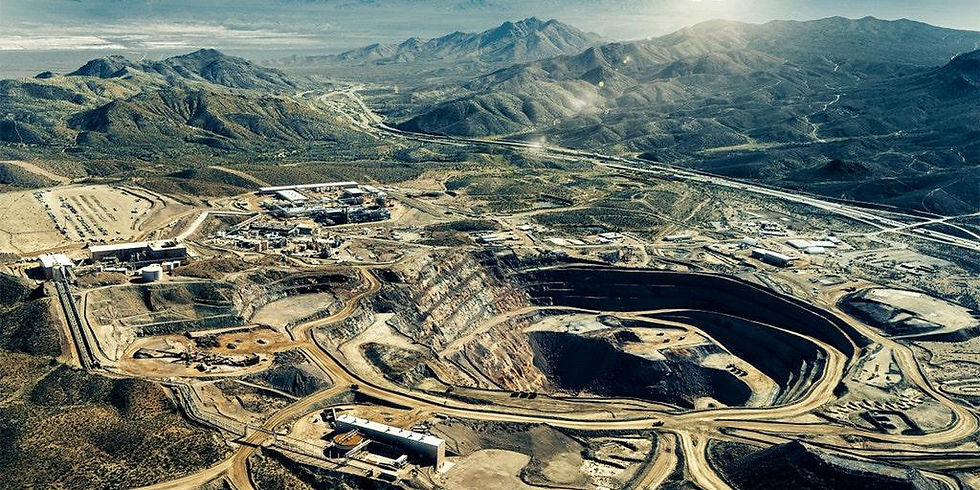
Visible geography marks the islands. Strategic geography measures what moves between them. Rare earths and the industrial chokepoint. Not every chokepoint sits along a shipping route. Some are built into the process of turning raw material into finished product. Rare earths are the clearest example. The name suggests something almost impossible to find, but the real bottleneck usually isn't geological scarcity -it's the capacity to extract, separate, refine and turn these elements into high-performance magnets. These materials go into electric motors, wind turbines, electronics, radar, guidance systems and a long list of military technologies. The path from raw rock to finished component runs through complex chemistry, expensive plants, and processes with serious environmental costs.
Over time, China built a dominant position not just in mining but, more decisively, in the middle of the supply chain. According to the International Energy Agency, Beijing controlled roughly 91 percent of rare-earth refining for magnets and 94 percent of sintered permanent-magnet production as of 2024 -and this year has shown exactly how that leverage can be used. In June, Beijing added ten American firms, including MP Materials and USA Rare Earth -the two largest recipients of federal investment aimed at building a domestic rare-earth supply chain -to its export-control blacklist, retaliating for U.S. moves against Chinese defense-linked companies. The escalation followed China's sweeping October 2025 export-control expansion, which extended Beijing's licensing authority to any foreign product containing even trace amounts of Chinese-origin rare earths, and briefly sent prices for magnet-grade materials sharply higher before a fragile truce, brokered at the Busan and Beijing summits between Presidents Trump and Xi, took some of the pressure off.
Those numbers explain why discovering a new deposit in Greenland, Australia, Canada or Africa doesn't automatically create an alternative supply chain: the ore still has to be processed. As long as separation and magnet manufacturing stay concentrated in a small number of plants, the chokepoint stays intact -which is exactly why Washington has spent much of 2026 racing to build one of its own, from a Strategic Critical Minerals Reserve modeled on the Strategic Petroleum Reserve to new critical-minerals partnerships with Australia and Japan and a February summit that drew ministers from more than 50 countries to Washington. It's a fundamental distinction: owning a resource isn't the same as controlling its value chain.
Western governments are trying to diversify supply, finance new plants, and rebuild lost industrial expertise. But a supply chain built over decades doesn't get replicated quickly: it takes permits, capital, skilled labor, agreements with local communities, and a willingness to accept environmental costs that had, for years, simply been outsourced elsewhere -American officials now estimate genuine self-sufficiency remains five to seven years away even with current investment levels.
The energy transition has its own geography of dependency. The nature of the resource changes; the competition to control it doesn't. Vulnerability tied to oil may shrink even as vulnerability tied to lithium, graphite, copper, nickel and rare earths grows. The electric motor doesn't erase geopolitics. It just moves it from the gas pump to the mineral-processing plant.
The power to stop without occupying.
In traditional strategy, controlling territory meant occupying it, defending it, administering it. In interconnected systems, exercising power takes far less: it's often enough to lean on the flows a country depends on.
A ship can be held in port. An insurer can decline to cover a route. A government can restrict the export of a critical material. A company can let maintenance lapse on a piece of infrastructure. A cable can be damaged under circumstances that are hard to pin on anyone. None of these actions, taken alone, necessarily amounts to an act of war. Together, they can sharply narrow a state's freedom of action. That's the political power of chokepoints: they allow coercion without ever crossing the open threshold of conflict.
The pressure can be calibrated precisely. A passage doesn't have to close forever -it can simply become temporarily more expensive. An export doesn't have to be banned outright -it can be subjected to new licensing requirements. A network doesn't have to be destroyed -it can suffer disruptions frequent enough to undermine confidence in it.
The gray zone thrives in the space between functioning and collapse. It's the zone where a system formally keeps working, but becomes less safe, slower, and more expensive.
Base Krigan and the logic of flows.
In the world of The Naacal Protocol -Code 211, Base Krigan matters not because it occupies a vast territory, but because it sits in a position from which movement across the High North can be observed and interpreted. Its narrative plausibility rests on the same logic that makes Pituffik, the GIUK Gap and cable landing stations strategically important in the real world.A remote base doesn't need to directly control a route to shape it. It can gather data, track naval units, intercept signals, and build a picture of the operating environment that no other actor has.
In the contemporary world, knowing the flow is knowing where to intervene.The decisive advantage doesn't always belong to whoever has the greatest force. It can belong to whoever first recognizes the point where a complex network turns fragile. That's where intelligence meets geography -not in the search for some mysterious location, but in identifying the node on which many consequences depend.Base Krigan represents that second map. Not the one of declared borders, but the one of dependencies.
The map of dependencies.
Suez, Hormuz, Malacca and Bab el-Mandeb show up on any atlas. Undersea cables, refining plants and port terminals require a different kind of map altogether. Laid over one another, these geographies reveal the real architecture of global interdependence.
Some countries control the resources; others control the processing. Some host the ports; others own the ships. Some hold the technology; others hold the territory those flows have to cross. No one is fully self-sufficient, but dependency isn't distributed evenly.
Globalization didn't make everyone equally strong. It built a system in which strength also depends on the ability to push the cost of a disruption onto someone else.A chokepoint becomes an instrument of power when whoever controls it can endure its closure longer than whoever needs it. The real measure of resilience isn't avoiding every crisis -it's how much time you have to adapt before the damage becomes politically unbearable, a lesson the past six months in the Gulf, the Red Sea and Panama have driven home with unusual force for American policymakers.
Governments are once again stockpiling reserves, diversifying suppliers, financing new mines, screening port investment and monitoring undersea infrastructure. This isn't the end of globalization. It's the end of the idea that efficiency alone can substitute for security.
The world will keep trading through interconnected networks, because no modern economy can walk away from the advantages they offer. But every connection will now also be assessed for the vulnerability it introduces.
The geography of power isn't only made of places that can be conquered. It includes the ones that can't be avoided. And it's precisely at the points where the world is forced to narrow that a local crisis can turn global -and competition can shade, almost without ever being declared, into control.
This article is part of the Grey Zones Archive editorial project, a long-form analysis series focused on Arctic geopolitics, strategic chokepoints, cognitive warfare, hybrid conflict, dual-use infrastructure and the evolving balance of power in the 21st century. The analyses published on The Naacal Protocol Blog explore the increasingly blurred line between intelligence, strategic geography and contemporary geopolitical narratives, in continuity with the research-based universe of The Naacal Protocol – Code 211 by Adelio Debenedetti.


Comments