The second map.
Secret bases, listening stations, dual-use infrastructure, and the clandestine networks beneath official geography. Every state has at least two maps.
By Adelio Debenedetti, author of The Naacal Protocol – Code 211

The first one is familiar. It shows borders, capitals, ports, airports, roads and cities. It's the public geography that underpins sovereignty and international relations: it marks where one country ends and another begins, which waters belong to which state, and which routes are open to navigation.
The second map is harder to read. Not because it's entirely secret, but because its pieces show up scattered and are rarely read as parts of the same system. It includes military bases, listening stations, radar sites, depots, airstrips usable in a crisis, commercial ports capable of receiving warships, undersea cables, data centers, and networks built to keep functioning when the ordinary architecture breaks down. The first map describes territory. The second measures what that territory can do. This dossier has followed the road from one to the other. Fear brought the weight of borders and alliances back to the surface. Greenland showed how a seemingly remote island can become a vantage point over space, the Arctic and the North Atlantic. Straits, ports, cables and rare earths revealed where the global network narrows down to the point of vulnerability.
What's left is to lay these pieces on top of one another.
Once you do, political geography doesn't disappear -it changes meaning. A civilian airport becomes a possible forward base. A commercial port enters military mobility planning. A scientific station collects data that may carry operational value. A digital backbone takes on the importance a rail line once had. An unremarkable building on the edge of a city can turn out to be the place where information gathered thousands of miles away gets filtered, interpreted, and turned into decisions. This is the second map of power. Not an atlas of conspiracies, but a picture of the structures that let states see, listen, move and endure -and it is, increasingly, the map on which Washington itself is racing to build its own next generation of defenses.
What the map doesn't explain.
Strategic installations aren't always invisible. Many can be spotted from commercial satellites, identified by their radar domes, or found in public documents. What usually stays classified isn't their existence, but their precise function: a sensor's range, what it watches for, and which networks it feeds.
Pituffik Space Base, in Greenland, is a case in point. It's on the map. It has an official website. Its stated missions -missile warning, space surveillance, satellite communications -are public knowledge. It isn't a secret base. And yet a photograph of its runway or its radar domes tells you nothing about what objects are being tracked, which signals count as anomalies, or how that information flows into the North American command structure. The gap between the public map and the operational one, then, isn't about whether a symbol appears on a chart. It's about how much meaning that symbol carries.
The same holds for the GIUK Gap. No official line crosses the Atlantic between Greenland, Iceland and the United Kingdom. Merchant ships sail through it without crossing any military border. For NATO and Russia, though, that space is a strategic threshold -its importance is written into submarine patrol routes, patrol-aircraft missions, sensor placement, and the plans for keeping North America and Europe connected. The second map doesn't invent a different territory. It reveals what the territory actually allows someone to do. Reading it means asking not just where a base sits, but what it can observe from that position, what it can support, which centers it talks to, and how long it would keep working through a crisis.
An isolated airstrip can look marginal until it turns out to be the only refueling point on a given route. A small port can become indispensable if it can repair a ship far from major bases. A weather station can generate data essential to air and naval navigation. A depot, almost irrelevant in peacetime, can determine how long an operation can be sustained. Official geography measures distance. Strategic geography measures dependency.
The bases that don't need to fight
The traditional image of a military base involves barracks, fighter jets, large units deployed on the ground. Many of the most important installations in today's system don't fit that model anymore: they house a handful of people, don't necessarily carry offensive weapons, and can look almost inert. Their job is to gather information or maintain a link.
A warning radar doesn't launch missiles, but it can buy the minutes needed to decide how to respond. A satellite ground station doesn't occupy territory, but it sustains communications without which deployed forces would lose coordination. A signals-intelligence site doesn't interrupt a transmission -it tries to recognize it, locate it, and fit it into a larger picture.
These are bases that produce operational knowledge. They turn scattered signals into a picture of the world. The United Kingdom hosts several sites tied to intelligence collection and processing, some known for decades and part of the intelligence relationship with the United States. RAF Menwith Hill, in North Yorkshire, is recognizable from its numerous white radomes shielding antenna arrays -a facility widely reported to be operated jointly with the U.S. National Security Agency and considered one of the largest signals-intelligence stations on Earth. The installation's physical footprint is obvious; the network of relationships it operates within is far less visible.
Another British site, GCHQ Scarborough, is described by the agency itself as the oldest continuously operating signals-intelligence station in the world, tracing its origins to a Royal Navy wireless-telegraphy station built in 1912. Today it contributes to gathering intelligence on terrorism, organized crime, and threats against British forces abroad.
The continuity matters. Technology changes, but the geography of listening has its own inertia. A location chosen because it could receive radio signals stays useful as long as it has staff, secure links, and expertise accumulated over decades -which is exactly the argument the U.S. intelligence community and the NSA have made for decades about their own network of stations, from Menwith Hill to bases across the Pacific. Listening stations don't have to sit near their target. They need a position compatible with the signal they're chasing, and membership in a network capable of interpreting it. The isolated station is only the ear. The real system is what happens afterward.
From interception to network.
During the Cold War, military communications moved by radio, microwave relay and satellite. Intercepting them required facilities in geographically favorable positions, and no single country could achieve broad coverage alone -it took bases, agreements, and cooperation among allied services.
The system known as ECHELON became the most famous symbol of that architecture. For years it was described in often wildly overstated terms, up to the idea of a machine capable of indiscriminately listening to every communication on the planet. The reality was more complicated -and, for that reason, more interesting.
A temporary European Parliament committee concluded that a global interception system did exist, built through cooperation among the United States, the United Kingdom, Canada, Australia and New Zealand under the UKUSA framework -the same "Five Eyes" alliance that remains the backbone of Western signals intelligence today. But that same inquiry also cut the myth of omnipotent surveillance down to size: the sheer volume of communications, technical limits, and the sheer labor of analysis made total, detailed monitoring of every message impossible.
That's an essential distinction for reading the second map without turning it into conspiracy theory. Intelligence networks don't see everything. They try to place sensors where something relevant is most likely to be intercepted. They don't eliminate uncertainty -they reduce it. They don't need to keep every piece of information; they need to recognize the ones that change a threat assessment.
Their power comes from combining geography with selection. A station in the right place can gather an enormous volume of signals, but the strategic payoff only comes when those signals get cross-referenced with satellite imagery, naval movements, diplomatic communications and open-source material. The second map, then, isn't a collection of bases. It's the diagram of the connections between them.
The Ocean as intelligence territory
In the North Atlantic, this network takes a particularly visible shape. The GIUK Gap isn't watched by a single system capable of perfect awareness of everything crossing the ocean. Operational awareness comes from combining different platforms: ships, patrol aircraft, undersea sensors, satellites, acoustic data, behavioral analysis.
During the Cold War, NATO and the United States built undersea listening systems to detect Soviet submarines, treating the ocean as an acoustic environment in which every vessel left a signature. The goal wasn't a physical wall, but recognizing a passage before a submarine could scatter into the open Atlantic.
Today that mission overlaps with protecting undersea infrastructure. The seabed carries telecommunications cables, energy conduits, sensors and links on which both civilian economies and military operations depend. The line between watching an adversary and protecting a network has blurred, because the same naval asset can approach both at once.
NATO has strengthened its Baltic presence with Operation Baltic Sentry, deploying frigates, patrol aircraft and naval drones to improve protection of critical undersea infrastructure. In the Arctic and the High North, it is also experimenting with networked, uncrewed systems for persistent, multi-domain surveillance -part of the same broader push, on the American side, that has funneled tens of billions of dollars into the Golden Dome missile-defense architecture the Trump administration launched last year, a proliferated constellation of tracking and interceptor satellites meant to feed threat data into NORAD and U.S. Northern Command in something close to real time.
The change isn't just about new hardware. It's about how knowledge itself gets built. A surface drone can watch a ship, an undersea sensor can detect a sound, a satellite can track a route, and an algorithm can compare the observed behavior against everything recorded before.
The second map turns dynamic. It no longer just shows where installations sit -it shows how data moves between them, and what operational picture it produces.
Infrastructure that changes function.
A military base is relatively easy to classify. A commercial port, a satellite network or a data center raise harder questions, because they can carry out civilian and strategic functions at the same time. That's what "dual-use" describes. It doesn't mean every civilian investment conceals a military project. It means some infrastructure has features usable in both worlds.
A runway long enough for large cargo aircraft can support tourism and, in a crisis, the movement of troops and materiel. A port terminal built for commercial ships can offer the depth, fuel and maintenance a fleet needs. An environmental-observation satellite can produce imagery of military infrastructure and movements. A civilian 5G network can carry communications essential to emergency management and defense alike.
The same ambiguity applies to private companies. A growing share of Western strategic architecture now depends on commercial services: satellite imagery, cloud computing, internet links, logistics capacity, port terminals. In a crisis, governments and militaries can find themselves relying on systems they don't directly control -a dependency Washington's own defense establishment has spent the past several years trying to address, from the Pentagon's growing reliance on commercial space companies to debates in Congress over how much of America's own critical infrastructure sits in private hands beyond direct federal control.
That raises flexibility. It also creates new dependencies. Private infrastructure answers to contracts, regulations and economic interests that don't always line up with national security. Its protection can fall to a different state than the one using its services. Data can cross multiple jurisdictions before reaching its destination.
The contemporary second map, then, is part public and part private. Its lines follow not only military alliances but also corporate ownership, port concessions, cloud contracts, and technology supply chains.
A country can hold full sovereignty over its own territory and still depend on infrastructure it has limited control over.
The civilian port in military planning.
Ports are among the most important pieces of this overlap. On commercial charts, they're measured in containers handled, wait times, rail connections. On military ones, they're assessed for water depth, fuel availability, capacity to unload heavy equipment, and distance from operational areas.
The two functions can coexist without the port ever formally becoming a base -it just needs to be able to offer access, resupply, or maintenance.
A foreign power's commercial presence at a strategic terminal doesn't automatically prove a military plan. But management control can bring knowledge of trade flows, political relationships, and familiarity with the infrastructure -advantages that, in a crisis, can turn out to matter in ways that weren't obvious at the time of the original investment.
This is especially sensitive along the Indian Ocean, Mediterranean and Arctic shipping lanes. Ports near Malacca, Bab el-Mandeb, or future northern routes belong simultaneously to economic geography and to security geography.
The same principle applies within continental Europe. NATO's ability to reinforce its eastern flank depends on being able to unload equipment, load it onto trains, and cross bridges and tunnels rated for its weight. Deterrence doesn't come only from front-line units -it comes from the civilian network that gets forces to them in time.
A highway can become a logistics line. A customs checkpoint can become an operational bottleneck. Regulations governing oversized-cargo transport can affect how fast a military response can actually move. The second map isn't always secret. Sometimes it's hidden in the bureaucracy.

The return of clandestine networks
During the Cold War, fear of a Soviet invasion produced, in several Western European countries, structures designed to operate after a possible occupation. These were the stay-behind networks -organizations meant, at least in their original conception, to maintain communications, gather intelligence, help personnel escape, and support resistance activity behind enemy lines.
Their function required secrecy. A network known in advance to an occupier would have been neutralized within days of a war starting. They needed vetted personnel, dedicated communications systems, hidden caches, and procedures kept separate from ordinary chains of command.
In Italy, this structure was known as Gladio. Its existence was made public in 1990 by Prime Minister Giulio Andreotti, and the network was subsequently disbanded. The revelation opened a political reckoning that went beyond the network's declared military purpose, touching on democratic oversight, how much elected institutions actually knew about the structure, and where defensive preparation ended and domestic political activity began.
Gladio deserves its own analysis -over the years its history has accumulated allegations, reconstructions and interpretations that need to be carefully separated from the documented record. What matters here is what it reveals about method.
A clandestine network isn't a secret base in the traditional sense. It's distributed infrastructure. Its value lies in being able to survive the loss of visible command centers: instead of concentrating people and equipment in one easily identifiable place, it separates them, protects them, and links them through procedures known to a small circle.
That logic doesn't belong only to the Cold War. Modern resilience strategies, even in very different legal and technological settings, share the same underlying need: prevent a single attack from paralyzing the whole system. Command centers get distributed, backup communications get prepared, data gets copied and protected, and governments study how to keep functioning through an emergency -concerns that have driven much of the post-9/11 American national-security bureaucracy, from continuity-of-government planning to the dispersal of federal data centers.
Yesterday's clandestine networks had caches and radios. Today's resilience runs on redundant servers, satellite networks, distributed operations centers. The democratic problem stays the same: who knows the full structure, who authorizes its use, and who oversees the people operating outside ordinary public visibility?
Secrecy and Oversight.
Every security system needs some measure of confidentiality. Publishing a sensor's true capabilities, its collection procedures, or the identity of a source would often destroy its usefulness. Secrecy isn't a defect of intelligence work -it's an operating condition of it.
The risk starts when the need to protect an activity makes it impossible to establish who is accountable for it. Democracies face a structural challenge here: they have to oversee organizations whose work can't be shown to the public in full. That requires rules, authorizations, legislative oversight committees, and judicial review capable of handling classified material -the exact machinery, imperfect as it often is, that Congress built after the 1970s Church Committee hearings into intelligence abuses, and that continues to be tested, debated and occasionally stretched thin in Washington today.
The question raised by the European Parliament's ECHELON inquiry was exactly this balance. Interception capabilities could be justified by national security, but they raised real questions about proportionality, the protection of private communications, and the risk that tools built for defense could end up serving political or economic ends.
A listening station isn't illegitimate simply because it collects signals. It becomes illegitimate if it operates outside any mandate, uses information for unauthorized purposes, or answers to no institution capable of actually overseeing it.
This is where gray-zone analysis has to hold itself to real discipline. The existence of classified structures doesn't prove an all-powerful hidden hand. It proves that states build tools meant to operate in a competitive environment. The useful question isn't whether everything is secret -it's which parts need to be, and what safeguards keep secrecy from turning into impunity. Conspiracy thinking fills gaps with certainty. Serious intelligence analysis measures them.
From radar domes to algorithms.
The Cold War's second map was relatively easy to picture: bases, antennas, bunkers, depots, cables. Today's version still includes all of that, but adds a software layer on top.
An algorithm able to analyze satellite imagery, recognize naval movement, or flag anomalies in communications can carry strategic value comparable to a physical station. The place where the computation actually happens can sit far from the sensor and the theater of operations: data collected in the Arctic can be processed at a center on the American continent and cross-referenced with commercial satellite imagery, social media, and shipping registries.
Britain's National Centre for Geospatial Intelligence sums up this shift in a simple line: everything happens somewhere. Geospatial intelligence combines imagery, maps and other sources to let decision-makers understand, plan, navigate and identify targets -the same discipline the U.S. National Geospatial-Intelligence Agency practices at far greater scale, feeding the same kind of fused picture into the command chains now being built around Golden Dome.
Geography is no longer just the backdrop for intelligence work. It's the language that links different kinds of data together. A satellite image shows a ship. Its automatic identification signal declares a route. An intercept suggests a mission. Weather data explains a course change. The history of past movements shows whether the current behavior is normal.
No single piece of information is enough on its own. The second map is built from stacking them together. That's why digital infrastructure has become a strategic target in its own right. Cutting off a data flow doesn't just block a single message -it can prevent the operational picture a decision-maker needs from ever forming. A force that can no longer see its own network, or its adversary's, can be paralyzed without losing a single base.

Base Krigan as a point of convergence.
Base Krigan, in the world of The Naacal Protocol -Code 211, belongs to the second map. Its narrative function comes not just from being hidden in a remote region, but from sitting at the point where multiple systems converge: surveillance, communications, space, Arctic shipping routes, intelligence.
A credible secret base can't exist as a self-sufficient island. It needs power, maintenance, personnel, resupply, links. It has to receive information and transmit some back. The more important it is, the more indirect traces it leaves in the network that sustains it.
That contradiction is what makes it interesting. Secrecy protects the location, but function creates dependencies: a runway needs resupply, an antenna needs to communicate, a computer system needs updates. Even the most hidden structure belongs to a wider geography.
In the real world, Pituffik is an observable model of exactly this logic. Its value comes from its polar position, but it only becomes operational through its links to NORAD, the satellite network, and command centers. The GIUK Gap offers a second example: the water doesn't become strategic on its own -it becomes strategic through the network of assets and sensors trying to interpret it. Base Krigan carries that architecture into fiction. It doesn't invent the principle. It concentrates it.
Geopolitical fiction becomes credible when its imagined setting obeys the same logistical and strategic rules as real places. It has to sit where geography offers an advantage -but it also has to belong to a network capable of using that advantage. The second map is the place where reality and thriller can overlap without being confused with one another.
Fear builds, then hides.
The first installment of this dossier argued that geography wasn't dead. Fear keeps redrawing borders and alliances because it forces states to imagine what could happen before it does. Finland and Sweden reread their own position through a changed sense of threat. The Suwałki Gap came back into focus as the vital link between the Baltic states and the rest of NATO.
Greenland showed the next step. A remote territory can become central when it lets someone see farther: Pituffik listens to space, the GIUK Gap concentrates attention on the world beneath the waves. The Arctic is no longer a periphery protected by ice -it's a region where shipping routes, resources and military capability are starting to overlap, and where an American president has, this year, made that overlap the subject of open diplomatic and economic pressure.
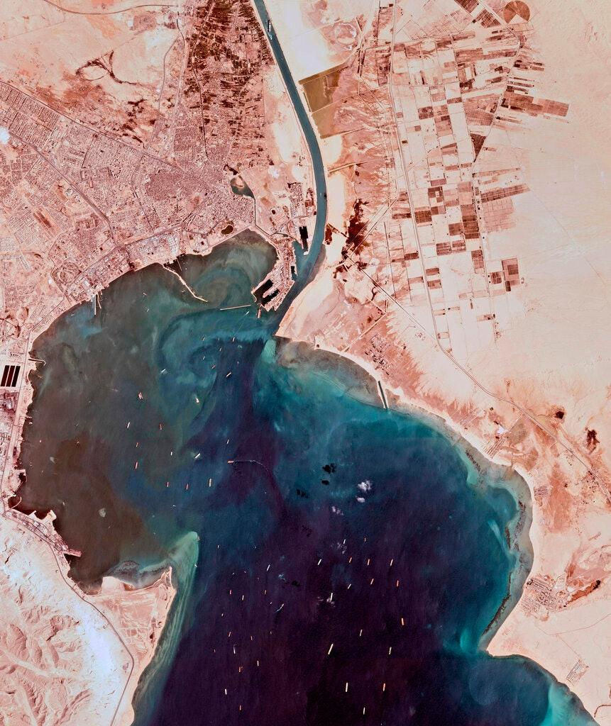
The chokepoints revealed the economic structure of that same fear. Hormuz, Malacca, Suez and Bab el-Mandeb matter not just because many ships pass through them, but because the alternatives are slower and costlier -a lesson driven home with unusual force this year, as war closed the Gulf's main artery for months on end. Undersea cables and rare-earth supply chains extended the same principle beyond the sea: data and technology depend on their own obligatory passages too.
The second map gathers up all these vulnerabilities and shows the responses states have built around them: listening stations to anticipate threats, dual-use ports to move forces, distributed networks built to survive an attack, sensors to watch the oceans, intelligence systems built to turn information into advantage.
Fear identifies the weak point. Strategy builds infrastructure around it.
And when that infrastructure genuinely matters, part of its function gets hidden.
The geography that decides before the war.
Wars get told through their battles, but they're usually prepared long before, in the placement of infrastructure. A force can only fight if it has information, fuel, ammunition, communications and routes of access. The second map determines whether those things will be available when they're needed.
That's why a listening station can matter more than a combat unit, and a commercial port can matter more than a fortified border. That's why a cable, a satellite or a refinery can enter national-security thinking without formally belonging to any armed force.
Contemporary competition increasingly plays out on this map long before it shows up on the official one. States invest in ports, negotiate access, distribute sensors, buy technology companies, and try to cut critical dependencies. None of these moves, on its own, amounts to aggression. Together, they can shift the strategic balance of an entire region.
A base doesn't need to be built after a crisis starts if it already exists as a civilian airport. A surveillance network doesn't need to be declared if its sensors belong to different owners and only share data when it matters. A corridor doesn't need to be closed if the risk alone makes using it economically unbearable.
This is the territory of the gray zone: the space where power gets positioned without yet being used openly. The first map tells us where states are. The second shows how they might act, what they're afraid of losing, and what structures they've built to keep functioning. The first map gets printed in atlases. The second only emerges by connecting radar, ports, cables, routes, depots and intelligence networks.
It's there, beneath official geography, that the future takes its position before it's recognized. And it's often on that map -long before the first shot is fired -that a crisis has already begun choosing its winners.
This article is part of the Grey Zones Archive editorial project, a long-form analysis series focused on Arctic geopolitics, strategic chokepoints, cognitive warfare, hybrid conflict, dual-use infrastructure and the evolving balance of power in the 21st century. The analyses published on The Naacal Protocol Blog explore the increasingly blurred line between intelligence, strategic geography and contemporary geopolitical narratives, in continuity with the research-based universe of The Naacal Protocol – Code 211 by Adelio Debenedetti.


Comments